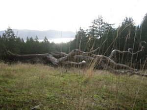
 Last weekend we went to check out the trail network at Channel Ridge here on Salt Spring Island. As part of the planning process for the new development up there our PARC department negotiated for the preservation of the existing trail network on the undeveloped areas. They have just completed a project to improve the access, signage and trails, and the results are impressive. We took lunch and spent a good couple of hours up there. The new map makes the access points easy to find, and together with the marker posts also makes the trails easy to follow. There are many kilometers of hiking with routes to suit all levels. I highly recommend it – I will try to get an electronic version of the trail map and post it here. We accessed the trails from Canvasback Road – see below – you can pick up trail maps at the information sign.
View Channel Ridge in a larger map
I really feel that this sets the standard for accessible hiking on Salt Spring. There is still a long way to go before we have an interconnected accessible trail network, but way to go PARC! Keep up the great work.
