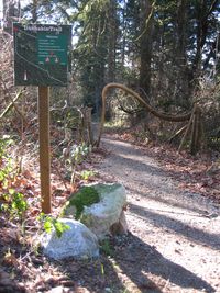
Well this is our local at least – a 0.8km Parc trail that runs from Stark's Road to Robinson Road though some lovely forest along side a creek. There is loads to look out for on this trail – we often see the barred owls here, as well as different types of woodpecker. There used to be beavers in the pond near the Stark's Road end of the trail but they seem to be gone now – although Emma did see an otter playing in the creek once!
Look out for the little bird houses, and the balancing rock sculptures created by Brian and his little dog Bug – there are always new ones popping up. There is also a Geo-cache on this trail somewhere – I met someone crashing around in the undergrowth looking for it once.
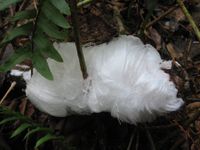
And if you find yourself on the trail on a cold winters day – normally when its been below freezing overnight with clear skies – look out for the Frost Flowers – you can find more details about how these beautiful ice structures form in our previous Frost Flower Post.
There are a lot of unofficial side trails around the park BUT PLEASE NOTE that if you take any of them you are almost certainly walking on private land.
You can access the trail from Stark's Road, closer to the east end, or near the bottom of the infamous 'dip' on Robinson Road. UPDATE – in the process of finding things to move to the cottage I found my Garmin GPS, so this is the first trail map with a GPS track showing the trail!
View Dunbabin Park in a larger map

